Dernière modification / Last update: 31 mars 2020
| Code |
EG Davidstow | ||||||||||||||||||||||||||||||||||||
|---|---|---|---|---|---|---|---|---|---|---|---|---|---|---|---|---|---|---|---|---|---|---|---|---|---|---|---|---|---|---|---|---|---|---|---|---|---|
| Coordonnées Coordinate |
|
||||||||||||||||||||||||||||||||||||
| Pays Country |
 Royaume-Uni (GB) Royaume-Uni (GB) |
||||||||||||||||||||||||||||||||||||
| Type de trafic Type of traffic |
VFR | ||||||||||||||||||||||||||||||||||||
| VFR nuit Night VFR |
Non / No | ||||||||||||||||||||||||||||||||||||
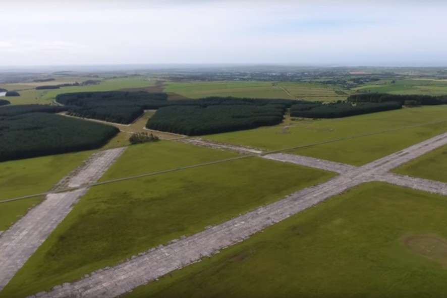
| Pistes Runways |
|
||||||||||||||||||||||||||||||||||||
| Radio ATC |
|
||||||||||||||||||||||||||||||||||||
| Altitude de référence Reference elevation |
965 ft | ||||||||||||||||||||||||||||||||||||
| Distance de la ville Distance of the city |
6.5 km SW Camelford | ||||||||||||||||||||||||||||||||||||
| Gestionnaire de l'AD AD administration |
Davidstow Flying Club +44 1566 731 981 +44 7793 799 676 |
||||||||||||||||||||||||||||||||||||
| HOR AD |
0900 - 1700 |
||||||||||||||||||||||||||||||||||||
| PPR |
Oui / Yes |
||||||||||||||||||||||||||||||||||||
| AVT |
MOGAS |
||||||||||||||||||||||||||||||||||||
| Aéroclub / Ecole de pilotage Flying club / Flying school |
Cf gestionnaire AD |
||||||||||||||||||||||||||||||||||||
| Restaurant Restaurant |
En ville / In the city |
||||||||||||||||||||||||||||||||||||
| Taxis Taxis |
Cornish Cabs +44 1840 213108 Shirleys Taxis +44 7743 743222 |
||||||||||||||||||||||||||||||||||||
| Vidéos Videos |
|||||||||||||||||||||||||||||||||||||
| Liens Links |
|||||||||||||||||||||||||||||||||||||
| Remarques Remarks |
Davidstow Airfield and Cornwall at War Museum |
||||||||||||||||||||||||||||||||||||
| Carte - Hôtel Map - Hotel |
Booking.com | ||||||||||||||||||||||||||||||||||||