Dernière modification / Last update: 1 avril 2021
| Code |
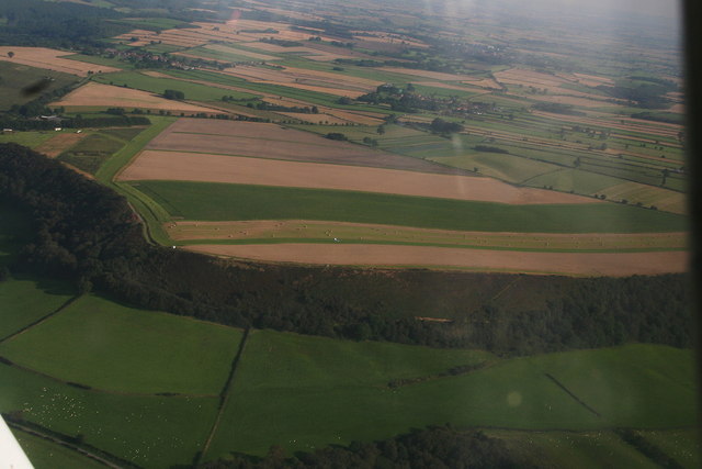
EG Fadmoor | |||||||||||||||||||||||||
|---|---|---|---|---|---|---|---|---|---|---|---|---|---|---|---|---|---|---|---|---|---|---|---|---|---|---|
| Coordonnées Coordinate |
|
|||||||||||||||||||||||||
| Pays Country |
 Royaume-Uni (GB) Royaume-Uni (GB) |
|||||||||||||||||||||||||
| Type de trafic Type of traffic |
VFR | |||||||||||||||||||||||||
| VFR nuit Night VFR |
Non / No | |||||||||||||||||||||||||
| Pistes Runways |
|
|||||||||||||||||||||||||
| Radio ATC |
|
|||||||||||||||||||||||||
| Altitude de référence Reference elevation |
780 ft | |||||||||||||||||||||||||
| Distance de la ville Distance of the city |
8 km N Wombleton | |||||||||||||||||||||||||
| Gestionnaire de l'AD AD administration |
P.H. Johnson +44 1751 431171 |
|||||||||||||||||||||||||
| HOR AD |
SS → SR |
|||||||||||||||||||||||||
| PPR |
Oui / Yes par téléphone / by telephone +44 7725 463676 |
|||||||||||||||||||||||||
| AVT |
NIL |
|||||||||||||||||||||||||
| Restaurant Restaurant |
1.5 km the Royal Oak +44 (0)1751 431 414 info@theroyaloakgillamoor.co.uk |
|||||||||||||||||||||||||
| Taxis Taxis |
RED's Taxis +44 70 9330 2585 Ryedale's Comfy Cars & Taxis +44 1439 377277 |
|||||||||||||||||||||||||
| Vidéos Videos |
||||||||||||||||||||||||||
| Liens Links |
||||||||||||||||||||||||||
| Carte - Hôtel Map - Hotel |
Booking.com | |||||||||||||||||||||||||