Dernière modification / Last update: 11 juillet 2018
| Code |
EGNU | |||||||||||||||||||||||||
|---|---|---|---|---|---|---|---|---|---|---|---|---|---|---|---|---|---|---|---|---|---|---|---|---|---|---|
| Coordonnées Coordinate |
|
|||||||||||||||||||||||||
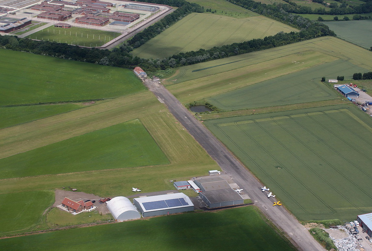
| Pays Country |
Royaume-Uni | |||||||||||||||||||||||||
| Type de trafic Type of traffic |
VFR | |||||||||||||||||||||||||
| VFR nuit Night VFR |
Non / No | |||||||||||||||||||||||||
| Pistes Runways |
|
|||||||||||||||||||||||||
| Radio ATC |
|
|||||||||||||||||||||||||
| Altitude de référence Reference elevation |
86 ft | |||||||||||||||||||||||||
| Distance de la ville Distance of the city |
5 km SE Stamford Bridge | |||||||||||||||||||||||||
| Gestionnaire de l'AD AD administration |
Full Sutton Flying Centre +44 1759 372717 fullsuttonairfield@gmail.com |
|||||||||||||||||||||||||
| HOR AD |
Lun → Ven / Mon → Fri 0900 – 1700 (0800 - 1800) Sam → Dim / Sat → Sun 0900 - SS |
|||||||||||||||||||||||||
| PPR |
Oui / Yes par téléphone / by telephone |
|||||||||||||||||||||||||
| AVT |
100 LL PPR |
|||||||||||||||||||||||||
| Aéroclub / Ecole de pilotage Flying club / Flying school |
Cf Gestionnaire AD |
|||||||||||||||||||||||||
| Restaurant Restaurant |
En ville / In the city |
|||||||||||||||||||||||||
| Taxis Taxis |
York Travel Ltd +44 1904 422911 York Cars Taxis +44 1904 765765 |
|||||||||||||||||||||||||
| Vidéos Videos |
||||||||||||||||||||||||||
| Liens Links |
||||||||||||||||||||||||||
| Carte - Hôtel Map - Hotel |
Booking.com | |||||||||||||||||||||||||