Dernière modification / Last update: 26 juillet 2018
| Code |
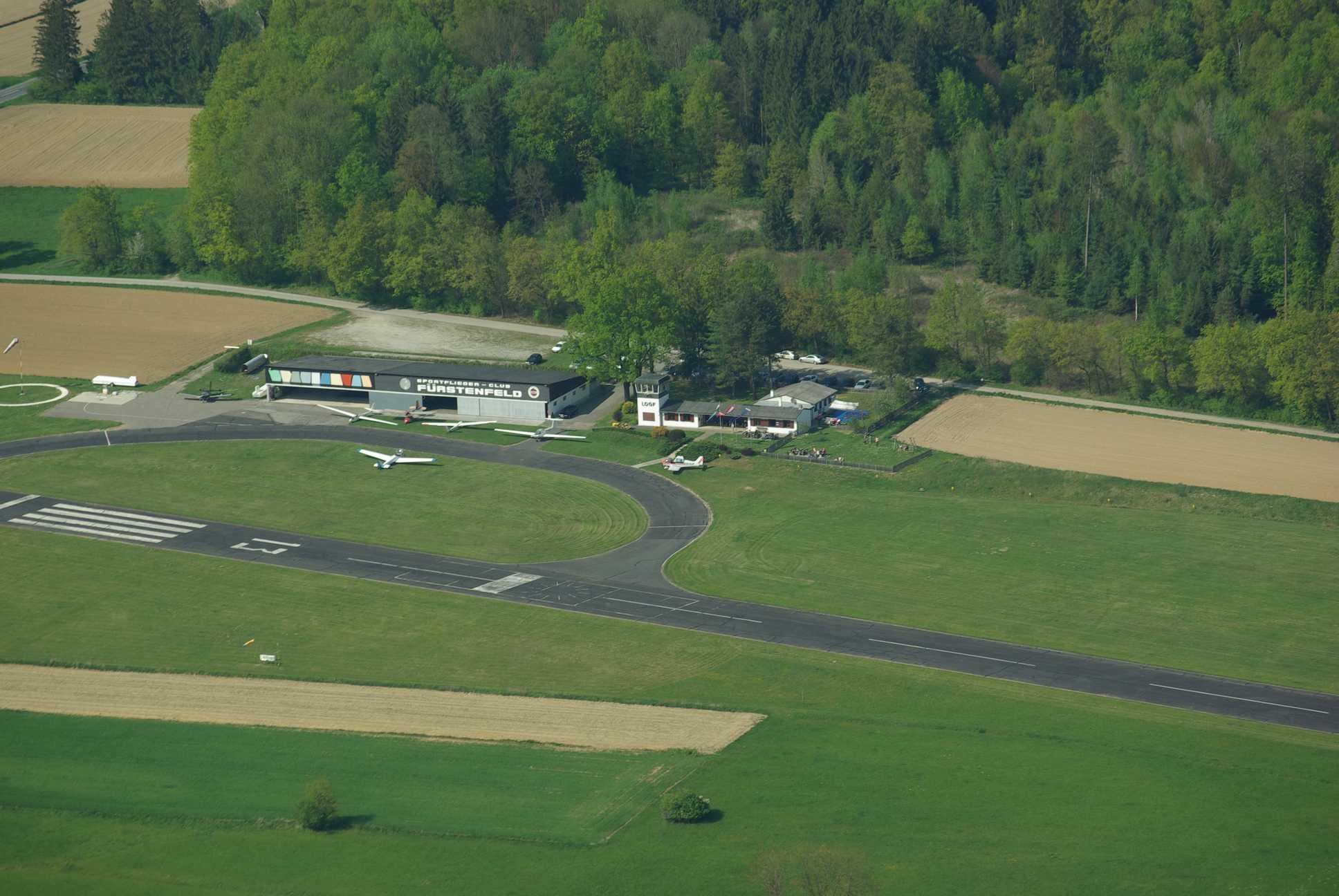
LOGF | |||||||||||||||||||||||||
|---|---|---|---|---|---|---|---|---|---|---|---|---|---|---|---|---|---|---|---|---|---|---|---|---|---|---|
| Coordonnées Coordinate |
|
|||||||||||||||||||||||||
| Pays Country |
Autriche | |||||||||||||||||||||||||
| Type de trafic Type of traffic |
VFR | |||||||||||||||||||||||||
| VFR nuit Night VFR |
Non / No | |||||||||||||||||||||||||
| Pistes Runways |
|
|||||||||||||||||||||||||
| Radio ATC |
|
|||||||||||||||||||||||||
| Altitude de référence Reference elevation |
830 ft | |||||||||||||||||||||||||
| Distance de la ville Distance of the city |
1,5 km N Fürstenfeld | |||||||||||||||||||||||||
| Gestionnaire de l'AD AD administration |
Sportfliegerclub Fürstenfeld +43 (0)3382 52666 |
|||||||||||||||||||||||||
| HOR AD |
Sam – Dim et JF 0800 / SS + 30 mn Sat – Sun and HOL 0800 / SS +30 mn |
|||||||||||||||||||||||||
| AVT |
100LL - Mogas |
|||||||||||||||||||||||||
| Aéroclub / Ecole de pilotage Flying club / Flying school |
Cf Gestionnaire AD |
|||||||||||||||||||||||||
| Restaurant Restaurant |
En ville / In the city |
|||||||||||||||||||||||||
| Taxis Taxis |
Taxi-Fürstenfeld +43 3382 55155 |
|||||||||||||||||||||||||
| Vidéos Videos |
||||||||||||||||||||||||||
| Liens Links |
||||||||||||||||||||||||||
| Carte - Hôtel Map - Hotel |
Booking.com | |||||||||||||||||||||||||