Dernière modification / Last update: 26 juillet 2018
| Code |
LOGP | |||||||||||||||||||||||||
|---|---|---|---|---|---|---|---|---|---|---|---|---|---|---|---|---|---|---|---|---|---|---|---|---|---|---|
| Coordonnées Coordinate |
|
|||||||||||||||||||||||||
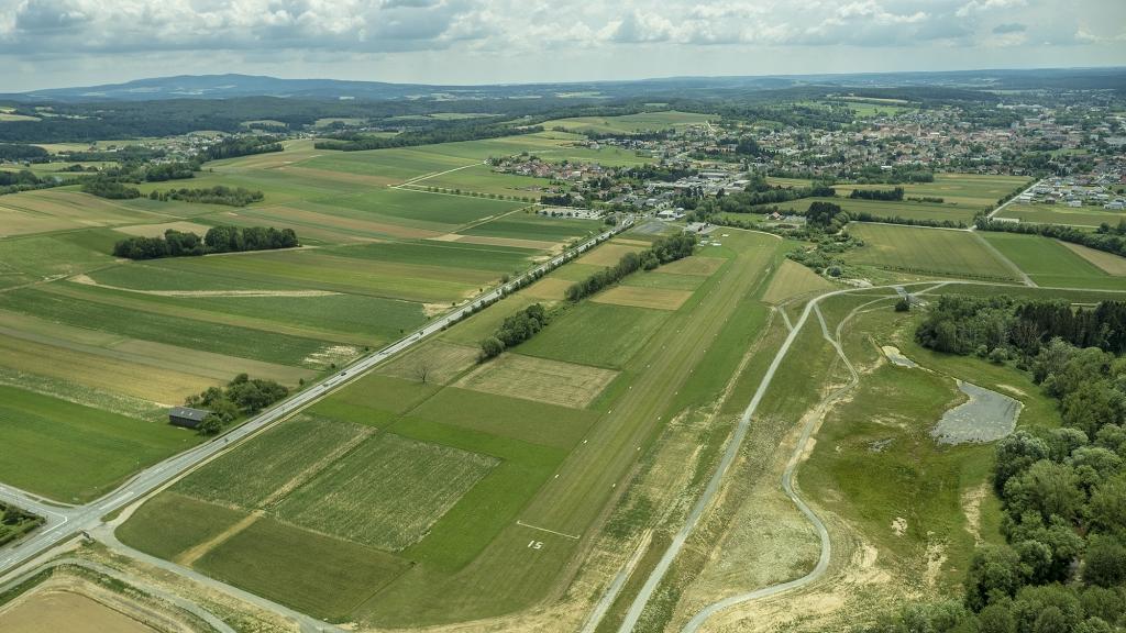
| Pays Country |
Autriche | |||||||||||||||||||||||||
| Type de trafic Type of traffic |
VFR | |||||||||||||||||||||||||
| VFR nuit Night VFR |
Non / No | |||||||||||||||||||||||||
| Pistes Runways |
|
|||||||||||||||||||||||||
| Radio ATC |
|
|||||||||||||||||||||||||
| Altitude de référence Reference elevation |
1338 ft | |||||||||||||||||||||||||
| Distance de la ville Distance of the city |
1 km N Pinkafeld | |||||||||||||||||||||||||
| Gestionnaire de l'AD AD administration |
Sportfliegerclub Pinkafeld +43 (0)3357 42498 office@logp.at |
|||||||||||||||||||||||||
| HOR AD |
Ete 0900 - SS Hiv selon l'état de la piste Sum 0900 – SS Win Depend on runway state |
|||||||||||||||||||||||||
| PPR |
Oui / Yes |
|||||||||||||||||||||||||
| AVT |
100LL |
|||||||||||||||||||||||||
| Aéroclub / Ecole de pilotage Flying club / Flying school |
Sportfliegerclub Pinkafeld, +43 (0) 3357 42498 office@logp.at |
|||||||||||||||||||||||||
| Restaurant Restaurant |
En ville / In the city |
|||||||||||||||||||||||||
| Taxis Taxis |
Taxi Riemer +43 664 88519181 Taxi Eibisberger +43 3357 46041 |
|||||||||||||||||||||||||
| Vidéos Videos |
||||||||||||||||||||||||||
| Liens Links |
||||||||||||||||||||||||||
| Carte - Hôtel Map - Hotel |
Booking.com | |||||||||||||||||||||||||